HIGH WINDS DISRUPT SUMMER EVENING IN WHITE COUNTY
Derek Smith • August 18, 2025
SUMMER HEAT AT ITS PEAK
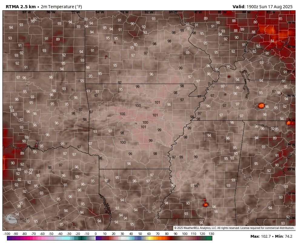
Across much of the natural state, we have seen the peak of summer hit with many highs around the state topping out at or above 100 degrees. Just in the central Arkansas part of the state, we saw temps hit 100 in places like Hot Springs, Russellville, Little Rock, Benton, Bryant, Conway and even in the town of Searcy as well. Overall we have seen temps in the 90s since early July with random spurts of 100 degrees around the state here and there. Today has really been the first real widespread day where most areas topped out near the century mark. Overall though, this has not been nearly as bad as those summers say back in 2011 and 2012 where we hit 110+ for an extended stretch during that August!
100 DEGREE HIGHS ON SUNDAY AUGUST 17TH, 2025
- Russellville 106
- Fort Smith 102
- Texarkana 102
- Mountain Home 102
- Batesville 102
- Little Rock 102
- Benton 101
- Conway 100
- Clinton 100
- Searcy 101*(this is important below)
HIGH HEAT LEADS TO HIGH WINDS
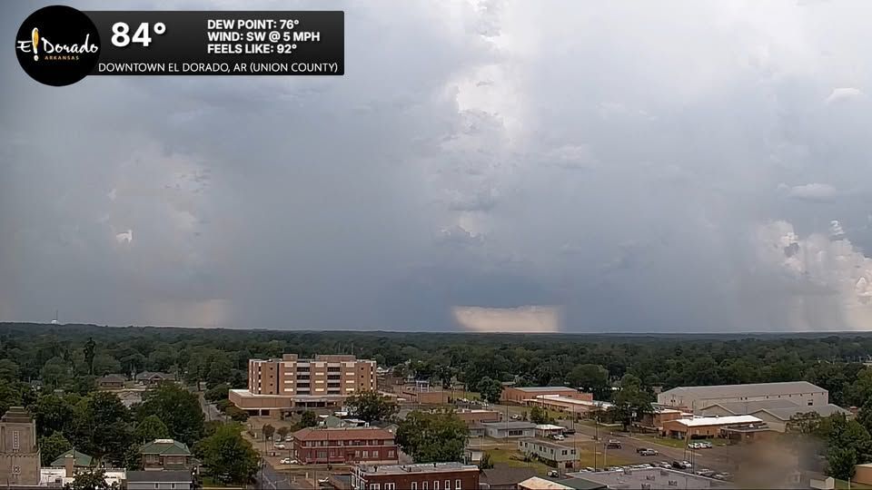
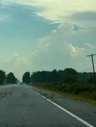
While most of us were hot and dry today with just the scorching sun on a summer Sunday to torcher (pun intended) us, others did happen to get relief in the form of a few isolated thunderstorms. Some of those storms produced very heavy rainfall and for a few communities in White County a little bit more than just your typical summer storm.
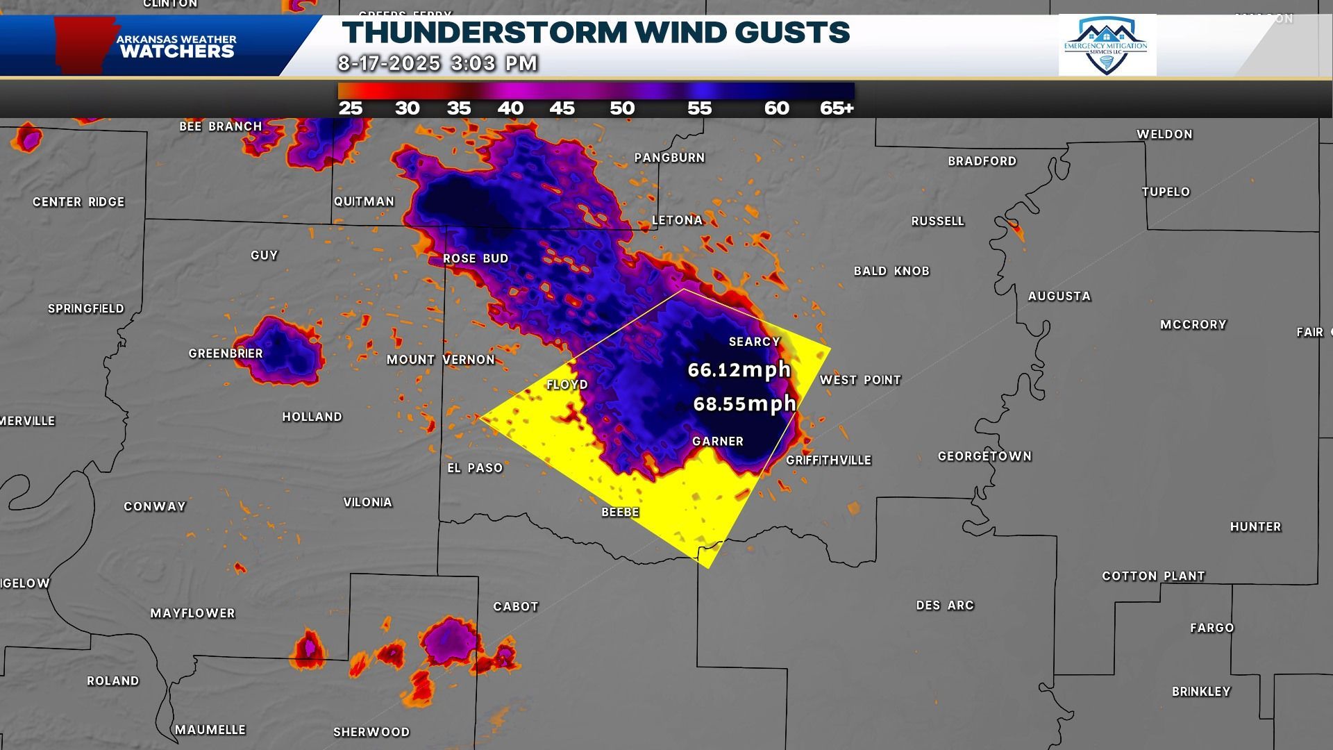
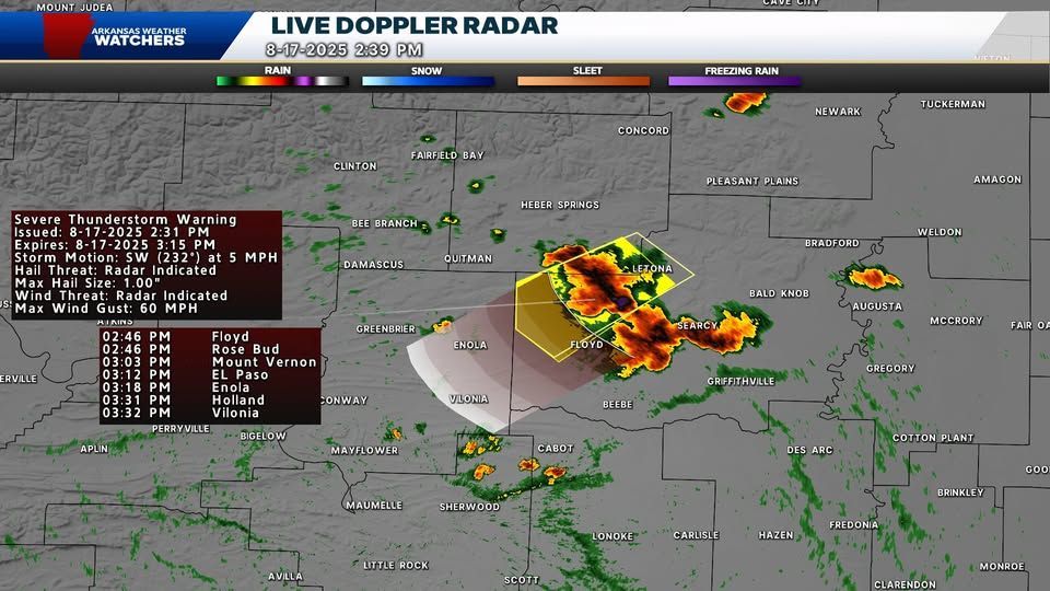
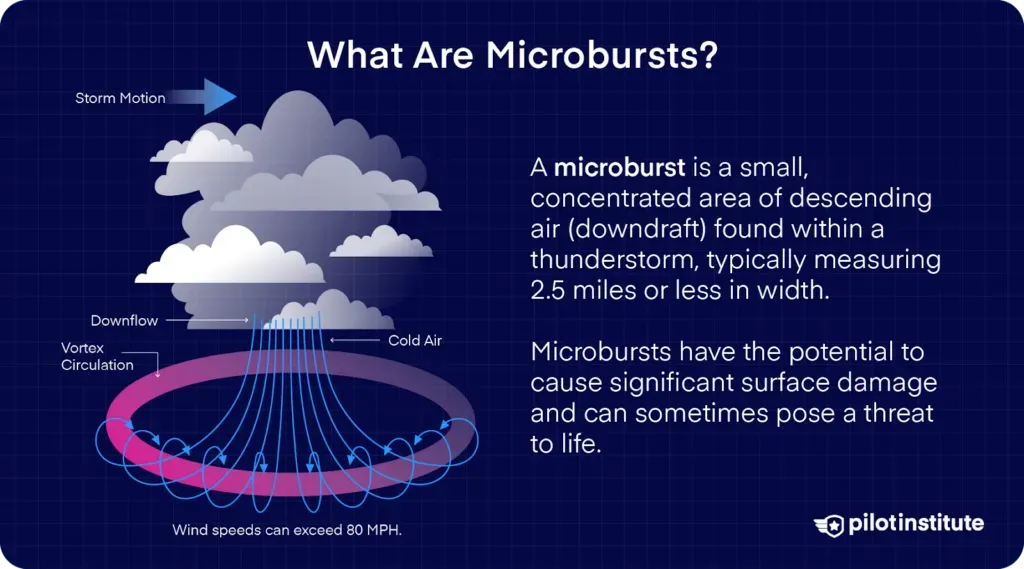
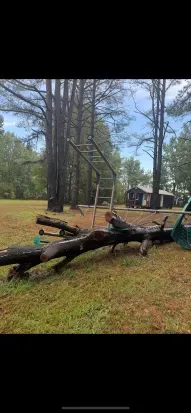
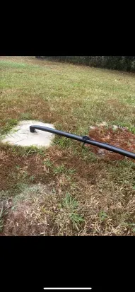
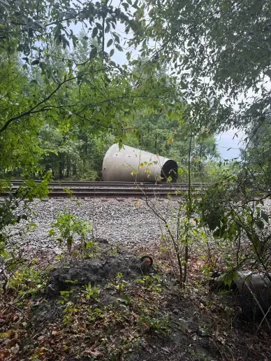
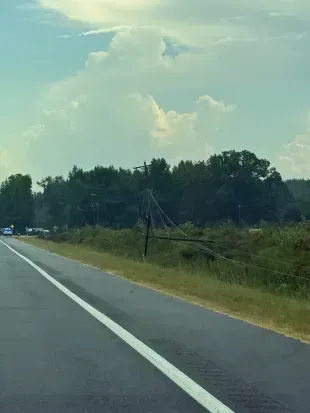
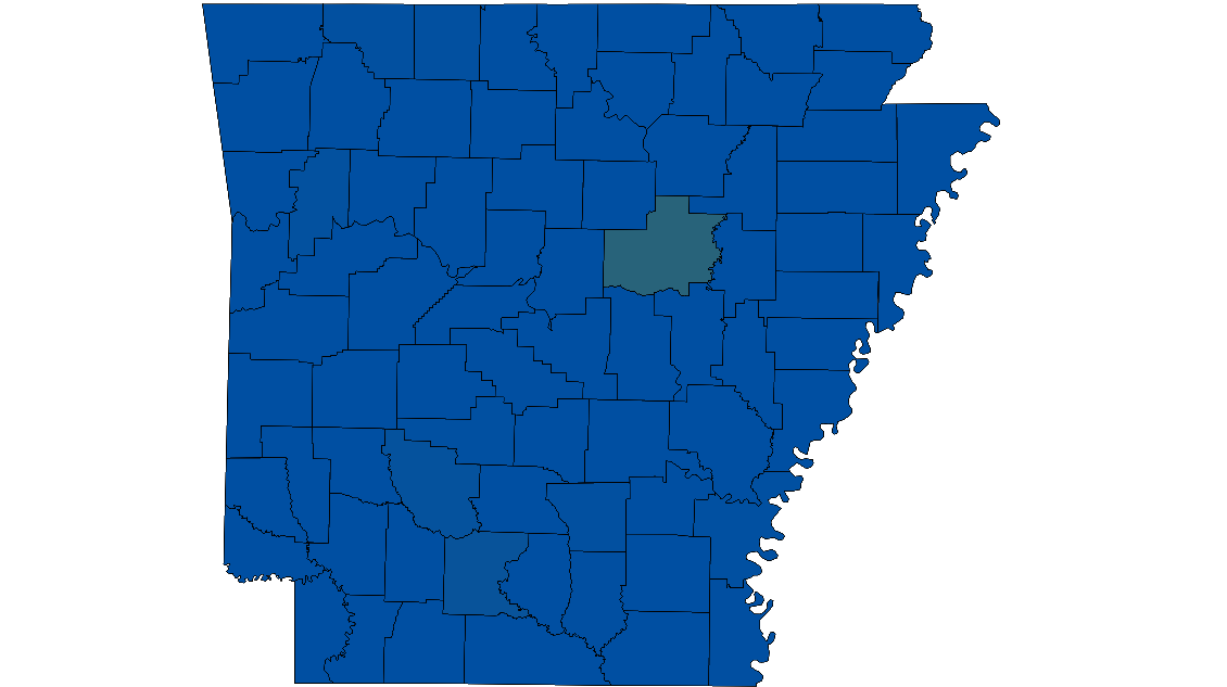
Over the course of the year we have had our fair share of high winds and tornado damage events especially in the months of April through June. While summer is not known for its severe weather, we do see severe weather in very isolated cases from time to time, yes even in a drought. For folks in the McRae, Garner and even up towards Searcy today where temps soared above the century mark, a strong storm developed which in turn led to more than just your typical afternoon pop-up. This led to a thunderstorm that produced 60 to 80 mph winds and led to tree damage, power line damage, and even some minor structural damage as well. This is what is known as a microburst which is defined from the National Weather Service as a localized downdraft of air within a thunderstorm that spreads out rapidly as it hits the ground, creating damaging straight-line winds. This is what led to a very localized area of damage across portions of White County on Sunday evening. Radar overall was very sparse around this time when it came to overall coverage but all it takes is one storm to cause a bad day.
DAMAGE, OUTAGES, AND CLEAN UP
As is always the case across the natural state, communities come together to clean up and move forward after each and every storm. White County is no stranger to damaging storms, you just have to go back a few months to see areas being hit with tornadoes and high winds. As is such the case now, unfortunately we did see damage in the area, but companies like Skyward Roofing and Emergency Mitigation Services were already on the phone, on the ground ready to assist with cleanups and repairs across the areas affected.
Sunday's storms also left power outages with most of those coming in from white county as of 8pm Sunday evening. Most of the outages were around the areas affected with a few stretching into areas around Searcy as well. With Monday’s forecast more of the same, power crews were already on the scene assessing the damage and prepping repair overnight ahead of more intense heat on Monday.
TROPICS COMING ALIVE?
As of this writing, the forecast team here at Arkansas Weather Watchers Media Group has not indicated anything of concern for us regarding the tropics as now Major Hurricane Erin rolls out to sea. A new system is brewing out in the Atlantic however, and Chief Forecaster/Vice President Cameron Barnes does say we could be watching this system down the road around Labor Day weekend IF it enters the Gulf. For now though, we just get to deal with that typical summer heat as we await that first fall front and of course football, bonfires and hopefully A LOT LESS severe weather than what we had this spring.
CAMERA PROJECT UPDATE!
Coming alive are weather cameras around the state! We will be having a lot more go up around the state over the next few weeks! As we talked about in the previous story, we are excited where this is going! Could a weather camera be coming to a town near you? Stay tuned……
~Derek Smith